


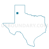
Voting District 0408, Castro County, Texas
About
Outline

Summary
| Unique Area Identifier | 671427 |
| Name | Voting District 0408 |
| County | Castro County |
| State | Texas |
| Area (square miles) | 214.43 |
| Land Area (square miles) | 213.69 |
| Water Area (square miles) | 0.74 |
| % of Land Area | 99.66 |
| % of Water Area | 0.34 |
| Latitude of the Internal Point | 34.60406760 |
| Longtitude of the Internal Point | -102.08563150 |
Maps


Graphs
Select a template below for downloading or customizing gragh for Voting District 0408, Castro County, Texas


Neighbors
Neighoring Voting District (by Name) Neighboring Voting District on the Map
- Voting District 0001, Deaf Smith County, TX
- Voting District 0001, Swisher County, TX
- Voting District 0004, Swisher County, TX
- Voting District 0007, Swisher County, TX
- Voting District 0101, Castro County, TX
- Voting District 0109, Castro County, TX
- Voting District 0304, Randall County, TX
- Voting District 0305, Randall County, TX
- Voting District 0401, Castro County, TX
Top 10 Neighboring County Subdivision (by Population) Neighboring County Subdivision on the Map
- Hereford East CCD, Deaf Smith County, TX (18,550)
- Canyon CCD, Randall County, TX (15,787)
- Dimmitt CCD, Castro County, TX (5,824)
- Tulia CCD, Swisher County, TX (5,738)
- Hart CCD, Castro County, TX (2,238)
- Kress CCD, Swisher County, TX (1,297)
- Happy CCD, Swisher County, TX (819)
Top 10 Neighboring Place (by Population) Neighboring Place on the Map
Top 10 Neighboring Unified School District (by Population) Neighboring Unified School District on the Map
- Canyon Independent School District, TX (51,224)
- Hereford Independent School District, TX (19,135)
- Tulia Independent School District, TX (5,817)
- Dimmitt Independent School District, TX (5,518)
- Hart Independent School District, TX (1,496)
- Happy Independent School District, TX (1,073)
- Nazareth Independent School District, TX (738)
Top 10 Neighboring State Legislative District Lower Chamber (by Population) Neighboring State Legislative District Lower Chamber on the Map
Top 10 Neighboring State Legislative District Upper Chamber (by Population) Neighboring State Legislative District Upper Chamber on the Map
Top 10 Neighboring 111th Congressional District (by Population) Neighboring 111th Congressional District on the Map
Top 10 Neighboring Census Tract (by Population) Neighboring Census Tract on the Map
- Census Tract 9502, Castro County, TX (4,557)
- Census Tract 219, Randall County, TX (4,125)
- Census Tract 9506, Deaf Smith County, TX (3,842)
- Census Tract 9503, Castro County, TX (2,238)
- Census Tract 9502, Swisher County, TX (2,016)
- Census Tract 9504, Swisher County, TX (1,297)
- Census Tract 9501, Castro County, TX (1,267)
Top 10 Neighboring 5-Digit ZIP Code Tabulation Area (by Population) Neighboring 5-Digit ZIP Code Tabulation Area on the Map
- 79045, TX (19,473)
- 79088, TX (5,945)
- 79027, TX (5,223)
- 79043, TX (1,487)
- 79042, TX (1,169)
- 79063, TX (686)